Field to office workflows are rarely straightforward. Manual steps pile up, rework drives up costs, and project deadlines slip. The latest Hexagon GeoCloud release is designed to change that. From photorealistic visualisation to connected field and office workflows, these updates help you get more from your geodata, accelerate delivery, and turn complex datasets into actionable insights that improve cost control and maximise ROI.
Here’s a look at what’s new and what it means for your projects.
Leica BLK360 imagery that closes the gap between capture and reality
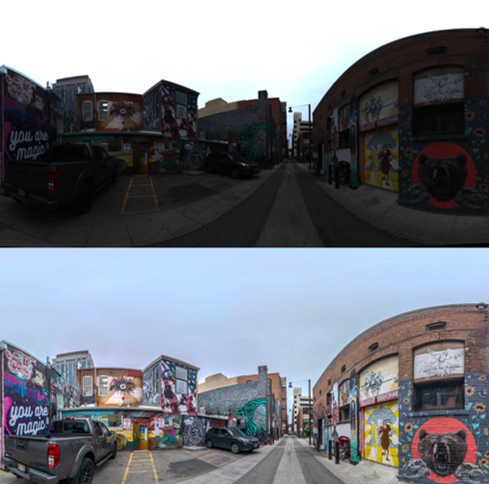
Image quality shapes every decision across field to office workflows. With AI-powered image beautification for the BLK360, imagery is enhanced automatically on import of LGSx files from the latest Cyclone REGISTER 360 PLUS into GeoCloud using computational photography, giving teams vibrant, more accurate-to-life visuals from the start with no manual clean-up or post-processing required.
Why image quality matters
- Stunning realism keeps clients confident. Deliver vivid, photorealistic, true-to-life imagery that meets the visual standard your clients expect, strengthening trust and reinforcing your reputation at every stage of the project.
- Eliminate manual image processing. Move straight into analysis and deliverables without post-processing delays.
- Improve accuracy across workflows. Work from clearer, more accurate-to-life visuals to validate conditions and produce reliable outputs.
- Maximise the value of every BLK360 scan. Generate more usable, high-quality geodata from each capture.
See the before-and-after comparison. Top: before. Bottom: now, with GeoCloud AI image enhancement.
Multi-data Scenes bring your project data together for faster, more informed decisions
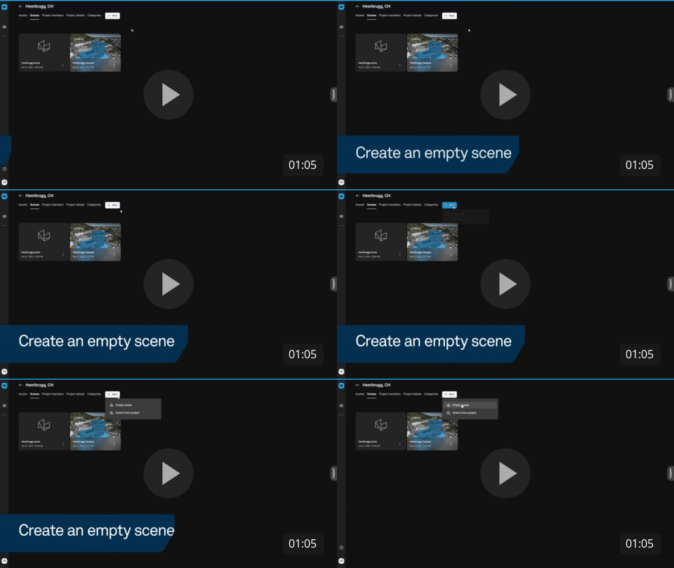
When project data lives across multiple files and tools, it is harder to stay aligned, spot issues early, make informed decisions, and communicate to teams and stakeholders. GeoCloud’s Scenes bring point clouds, meshes, models, and other project 3D artefacts together in a single shared workspace (a “scene”) so teams can visualise, review, and collaborate in context, identify issues earlier, and accelerate project delivery.
How teams benefit
- Create one clear, shared project view. Keep teams aligned and working from the same context, reducing miscommunication and unnecessary back and forth.
- Spot issues earlier and accelerate project delivery. Identify clashes and discrepancies sooner to reduce risk and avoid costly rework downstream.
- Tailored to your use case. Create unlimited scenes per project, allowing specific workflows or project stages and milestones such as design reviews or as-built inspections for specific site elements to stay focused and productive.
- Stronger stakeholder communication. Improve transparency with clear, shared visualisation that supports audits, dispute resolution, and post-project analysis.
Watch it in action:
Switch between coordinate systems and export with confidence, without duplicating assets
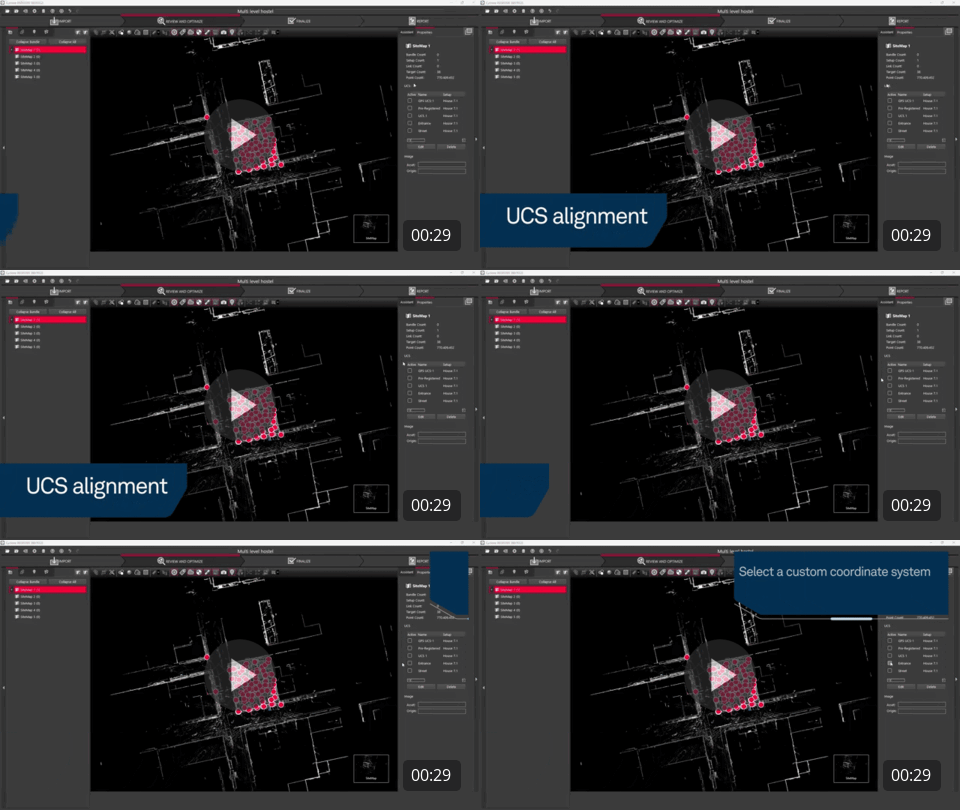
With improved Active UCS support from LGSx files, GeoCloud ensures that 3D view orientation, SiteMap orientation, export, measurement, and GeoTag workflows all respect the Active UCS set in Cyclone REGISTER 360 PLUS before publishing to LGSx.
What this delivers
- Skip large E57 exports and benefit from LGSx compression. Eliminate publishing and uploading larger E57 files while gaining LGSx compression.
- Maintain accuracy across coordinate views. Measurements, GeoTags, grids, SiteMaps, and levels in the minimap, plus tours, all respect the Active UCS, reducing the risk of errors from visual confusion.
- A foundational change that improves usability without changing source data. This effort will be expanded later in the year to let users switch between multiple UCS views saved in the original LGSx file in one click.
See it for yourself:
Extend the value of your legacy pano-only data with TruView Cloud and TruView Enterprise migration support
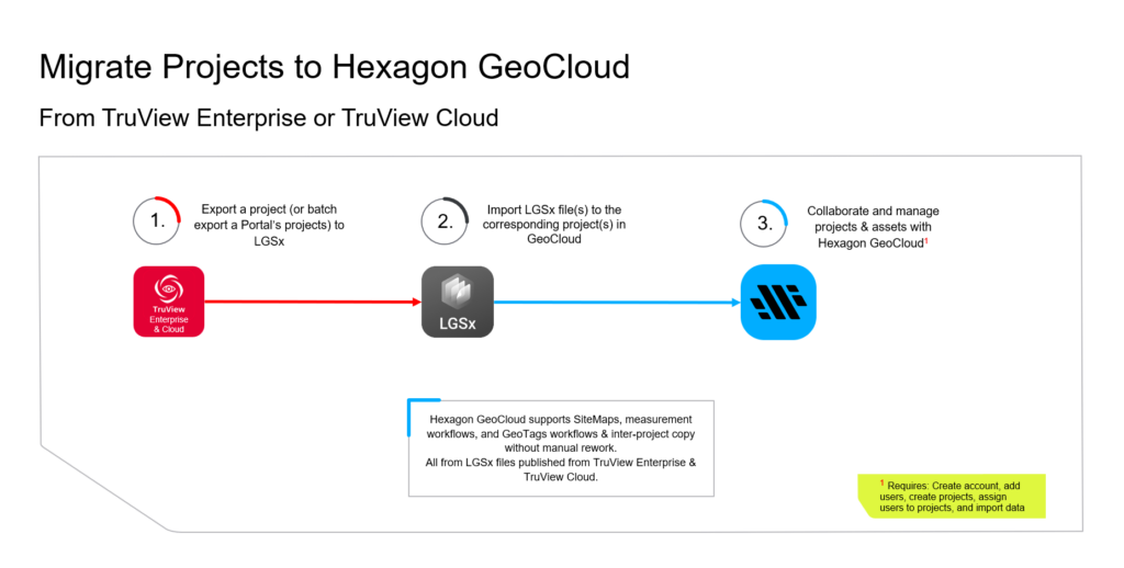
For teams working with or retaining legacy pano-only data, GeoCloud supports LGSx files exported from TruView Cloud or TruView Enterprise, including full support across SiteMaps, measurement workflows, and GeoTag import. Maintain access to legacy and active projects with full functionality in GeoCloud. Batch export options in the TruView products make it straightforward to transition large datasets without manual rework, helping teams extend the value of their existing data without recapturing the site.
Migrate with ease
- Scale migration without disruption. Export individual sites or full portals as LGSx files and transition large datasets efficiently, without manual rework.
- Accelerate setup with minimal friction. Quickly configure accounts, users, and project structures to align with existing workflows and reduce onboarding time.
- Ensure reliable data transfer at scale. Use HxDR Data Flow to queue and manage uploads, reducing the risk of failed transfers, even with large volumes or unstable connectivity.
- Maintain familiar project structures. Recreate portal structures within GeoCloud to preserve how teams access and navigate data, ensuring continuity across the transition.
- Control access with precision. Assign project roles and permissions so stakeholders have the right level of access, improving collaboration while protecting data integrity.
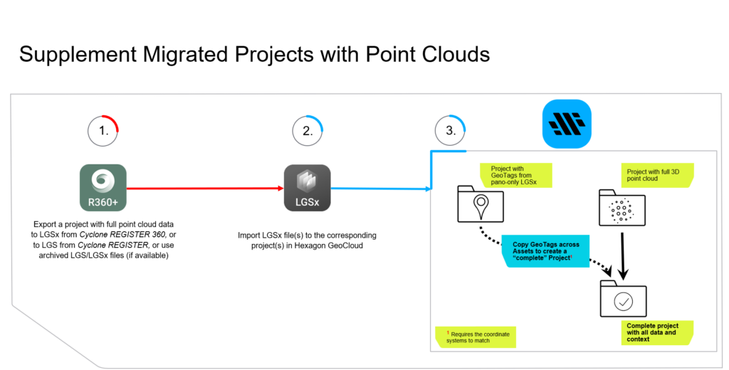
- Upgrade the user experience and data utility. Bring archived 3D point clouds of the same TruView Cloud or TruView Enterprise projects into GeoCloud and merge GeoTags across data for a richer, complete, 3D GeoTag experience.
Select the workflow that works best to migrate your projects to Hexagon GeoCloud:
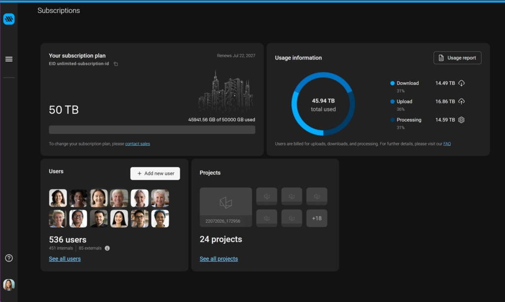
Export subscription consumption metrics per project to simplify chargebacks and client billing
As usage scales across projects, tracking and allocating costs can quickly become complex. GeoCloud enables teams to export subscription consumption metrics with project-level detail, giving clear visibility into how data is used and where costs are incurred. This supports internal cost allocation, project reporting, and client billing without manual tracking or fragmented reporting.
Allocate costs with confidence
- Align project costs to actual usage. Attribute data consumption directly to projects, teams, or clients for more accurate cost allocation.
- Simplify chargebacks and client billing. Reduce manual effort with clear, exportable usage data to support internal and external billing.
- Improve project-level visibility. Track how data is consumed across projects to support reporting, budgeting, and forecasting.
- Increase financial transparency. Give stakeholders clear, data-backed insight into usage and associated costs.
See how usage tracking looks in Hexagon GeoCloud: