See how Arcadis boosts customer satisfaction and delivers over £100K in client savings with Hexagon GeoCloud:
Challenges
Data volume bottlenecks: Point cloud datasets were extremely large and difficult to move across global teams, resulting in slow transfers and multiple local copies of the same data.
Site visibility gaps: Made it difficult for teams and stakeholders to collaborate, review conditions, and stay aware of safety issues without being on-site.
Cost pressures: Inefficient workflows and repeated site visits created unnecessary project costs, especially for clients who needed to revisit controlled or restricted sites.
Solution
Centralized cloud data environment: Hexagon GeoCloud provides a single, cloud-based location for all spatial data, giving Arcadis a consistent digital record of every site and eliminating the need for repeated site visits.
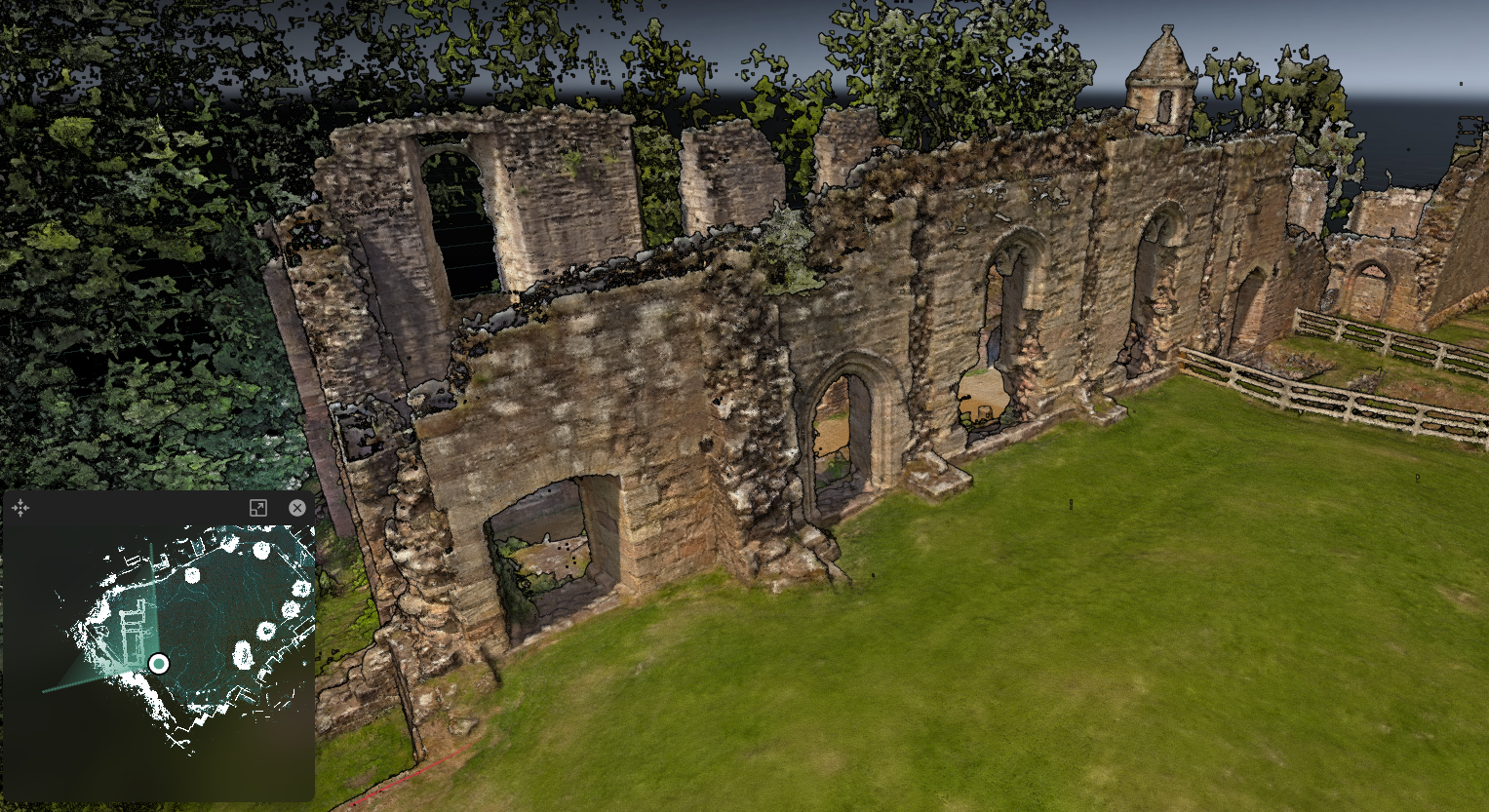
Enhanced remote visualization: Virtual walkthrough capabilities allow clients and internal teams to navigate sites from anywhere, which is especially valuable for controlled or restricted environments.
Improved global collaboration: The platform supports real-time access for distributed teams, allowing Global Excellence Centers and regional offices to work on the same dataset simultaneously and maintain a continuous workflow across time zones.
Value
Increased demand for digital walkthroughs: Clients now regularly request 3D walkthroughs as part of project deliverables, with some projects commissioned specifically for data visualization—a shift that did not exist before adopting Hexagon GeoCloud.
Greater clarity and accessibility: Both internal teams and external clients access survey data directly within Hexagon GeoCloud, improving visibility, accuracy, and collaboration across disciplines.
Significant cost savings for clients: For one project, virtual walkthroughs removed the need for repeated site visits, saving approximately £3,000 per location and delivering an estimated £120,000 in savings across 40 surveyed sites.